
The All-Weather Rollercoaster of 2019

It seems none of the old rules apply anymore when it comes to weather, except perhaps the adage that if you don’t like what’s happening today just wait a bit because tomorrow will be different. The bit about April showers and May flowers does not apply to 2019.
Wake up Call
Only 6 months ago California was on fire. I remember feeling so horrified and so absolutely helpless as the news of the Paradise fire reached the air waves. The fact that Paradise had been consumed by a raging inferno seemed to portend a cataclysmic change in our way of life here in California- it was like the end of the world. The California Dream, gone down in flames, our beautiful state reduced to ashes.

No one was safe. Any errant spark could take down whole communities. It was a shock to realize how vulnerable we were.
Then the storms came. One after another, the storms dumped snow in the mountains and torrential rains at lower elevations. Massive treefalls and blowdowns brought down power lines and left splintered wreckage all through the forests faster than repair crews could replace them, exposing even more plainly than ever the fragility of our infrastructure.
It was a wake-up call for sure. The message: We need smarter planning, better preparedness, wiser investment in maintenance. Lose respect for the power of Mother Nature at our peril. Don’t take good fortune for granted; don’t squander our rich natural resources.
 A Change
By the end of March I felt bruised and battered and done in. I had done my best to keep on tromping through rain, snow, sleet, and hail, ticking off my daily allotment of 7.5 miles of hiking for rhinoceros. I like cool weather and it’s nice to see the streams and waterways running full. I draw the line at mud though. I don’t like mud. The dogs tracked enough mud into my car to plant potatoes. So by April I was really ready for a change, ready for spring, as were the rest of Californians. And for awhile in April it seemed that perhaps the worst was over. Maybe it was okay to go our and start that summer vegetable garden, plant some flowers.

Things are certainly looking better than they have in a long time- the reservoirs are full, the drought is officially over, the snowpack is way above normal, the world is green and wildflowers are starting to show signs of putting on an extravaganza of color. The ticks were horrible- they love the wet weather and emerge by the billions as soon as the temperature rises, but I learned a few tricks for dealing with them. Rattlesnakes are harder.
Tips for Ticks

One day while tromping around Fleming Meadow I met two tick biologists working for the Department of Public Health, doing tick surveillance. I invited them to sample the dogs, but they were doing fine collecting samples from down dead logs and underbrush. They were taking them back to the lab to test for diseases such as Lymes, erhlichia and rocky mountain spotted fever. The good news is that the incidence is low. The bad news is that there are a LOT of ticks. I learned to avoid sitting on dead logs and apply insecticide to exposed skin. I was diligent about using tick control on the dogs, and checked them constantly, especially since they like to sit in my lap!
Hat Creek Rim
In May I took 3 weeks off from work to go outside and visit the brand new world emerging from the past months of fire and ice.

I decided to do a backpacking trip, because nothing is more refreshing to the soul than a total immersion getaway into the wilderness. The hard part was figuring out where to go! There were still storms all over the southwest, all the way to Denver. Even now there remains a formidable amount of snow in the high country, even in up north in the Trinitys and the Cascade Mountains. A ranger stationed in Lassen National Forest advised me that the Pacific Crest Trail from just north of Lassen Park all the way up to Burney Falls was not only free and clear of snow, it was exceptionally green and full of wildflowers like never before! So on May 9th Lyssa and I packed our packs and headed north.  I picked a spot where we could go in and hike for 3 days and then turn around a go back to the car, or perhaps continue a bit further to a place where we could get a ride back or starting place. So we could stay out for 6 days and hike as fast as we wanted or take our time. It was a good plan.

The area we hiked was the notorious Hat Creek Rim, known and dreaded by PCT through hikers for being the hottest and most waterless section of the whole trail. But they are usually doing it in July and August, when everything has been baked and turned to dust by the summer sun. It’s a different story in May, especially after record rainfalls.

The Hat Creek Rim is a volcanic plateau. Everything you can see from the rim is shaped by volcanic activity. Mount Lassen last erupted just over 100 years ago, sending avalanches of mud and ash and debris over the whole region and reshaping the waterways. It was as cataclysmic as our wildfires, only there were a lot less people around to be disrupted by it. The soil is very porous, so water quickly drains away unless it is stopped up by something. But when there is water the nutrient rich volcanic soil supports a great diversity of forests and meadows and wildlife.

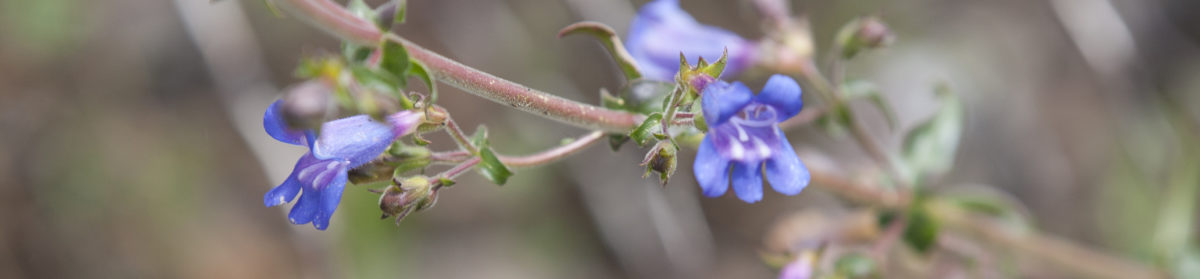
And this year there is water. I had 6 days of spectacular views and kaleidoscope of color. I stopped so often to take photos that I ran my batteries down every day and it’s a wonder I made any progress at all. Lyssa enjoyed herself as much as I did, pouncing on small scurrying critters (but not catching them). I kept her close on a leash most of the time. Even though water was relatively abundant for Hat Creek Rim I had to be careful in planning my stops and carry enough to get us through some of the longer dry stretches. Because it was hot in the afternoons and the concern for having enough water for myself and for Lyssa, we sometimes had to put in a few more miles per day than we would have liked.

Some sections of the trail were rough and rocky with sharp volcanic material, which was hard on Lyssa’s feet, and so I ended up carrying Lyssa’s packs for her for a few hours every day, but she was happy to get on the trail every morning and by the end of the trip she was still pouncing on anything that rustled the leaves or scurried under the brush.

We made it all the way to Burney Falls, which is spectacular place in and of itself. Go see it! The Pacific Crest Trail runs right along next to the park, and hikers can take a side trip over to see the falls and visit the park general store, (and fill their bellies! I had an egg salad sandwich and Lyssa had roast turkey.) There is a nice campground for the public and another one set aside for backpackers and PCT hikers, which was where we stayed, and we had it all to ourselves!


In fact, we had the whole trail pretty much to ourselves for the whole trip. The only exceptions were a handful of PCT “through- hikers” who had “leapfrogged” past the snowed-in high peaks of the Sierras. It’s turning out to be a rough year for through-hiking. On the last day of our little Hat Creek adventure the weather turned cold and cloudy, erasing the spectacular vistas of Mount Lassen and Shasta, and muting all of the vibrant colors on the plateau. We had been lucky.

The Colorado Road Trip
After a few days of R&R at home I packed up the car for a reconnaissance expedition to scope out parts of the Colorado Trail in preparation for summer. This time in addition to Lyssa I brought along the whole A team- Tina, Sarah and Lucy. After the Last Road Trip in the RV last fall, they are pretty good at road trips. Having dogs along on a road trip means you have to choose your stops carefully and you have to make more of them than you would otherwise.
 The first night we camped in the middle of Nevada at a BLM managed campground in an area rich in petroglyphs. Camping on BLM land is more primitive and unregulated than parks, but the price is right. We stayed at the Hickman Petroglyphs and found time to do some hiking and exploring.
Utah

The second night we found a place just below the snowline in Fish Lake National Forest in Utah. This region is managed as a “multi-use” forest, and features dispersed camping, with opportunities for OHVers, hunters, hikers and lots of free range cattle. It was tricky finding a place to camp below the snowline that was free of mud. We enjoyed a long walk on the road, and only had to dodge a handful of jeeps. Overnight the first wave of stormy weather started to catch up to us. After a quick early morning walk we headed east.

Scoping the Colorado Trail
 The third night we made it to Durango and camped at Junction Creek, the southwest terminus of the Colorado Trail. In the evening we hiked a few miles up the trail and back, under threatening skies darkening with thunderheads. That night the rain and snow caught up to us and we woke to a wet world. I’m happy to report that my little tent held up to the rain and all 5 of us stayed warm and dry. It was a cozy night!
Snow!

Leaving Durango, our road headed up into the mountains, crossing several passes on the way to Silverton, a famous rustic old frontier mining town. It’s situated very near the Trail, and I was eager to see it. Unfortunately as we gained elevation the rain turned to snow and by the time we reached Molas Pass we were in a blizzard! There was a foot of snow in Silverton, and the road was not well plowed. I decided there was no point in visiting other passes or trail crossings since they would be inaccessible in the snow.

So headed for Denver via highway 50 and Monarch Pass.
But first, we had to get through Red Mountain pass and the town of Ouray. Fortunately the road north of Silverton was not as snowy and we hadn’t gone too far along when the road became more passable. I was very happy and relieved, because the highway around Red Mountain was the curviest- and most spectacular- pieces of road that I have ever driven! I’m glad I had a chance to see it. It was a nice place to visit, as they say, but I don’t think I’d want to live there.

Anyhow, we persevered eastward along highway 50 over the vast Blue Mesa and through Gunnison, crossing multiple high snow- blown passes and open rangeland. I kept checking the forecast and the road conditions, and very time I checked it seemed worse than the time before. Finally I gave up and called ahead and booked a hotel room for the night, near Denver. I have my limits.
In the morning we woke up to eight inches of snow. I can only imagine what it must have been like along all those high passes and mountain towns we came through. The dogs got me up at 5 to go outside to do their business (Lyssa stuck her head in the snow and sniffed intently at all the rabbit tracks in the field by the hotel). After I scraped all the snow off the car I studied the road conditions and forecast while enjoying a large continental breakfast. Interstate 70 was open, with only a few questionable spots around Vail and Copper Mountain, so we headed west, with stops to scope out a couple of Colorado Trail resupply towns along the way.
I didn’t take many photos; not that the scenery wasn’t spectacular, but I just couldn’t begin to capture it. You just have to see it for yourself, and be sure to do the drive through Glenwood Canyon. It’s just so amazing and unbelievable that an Interstate highway was built through it. Not only a multi-tiered four lane road but a railroad line and there’s a bike trail along the whole way too!

We made it as far as Green River, on the eastern edge of Utah, and then crossed the spectacular San Rafael formations in the early morning while the rising sun spotlighted the canyons and buttes. I couldn’t not stop and take photos! For hours we were treated to gorgeous scenery as we passed through central Utah, but then came Nevada.
Home!

I had planned to camp the final night of the trip somewhere in Nevada, preferably at a lower elevation where there was less chance of rain and snow. But as soon as we crossed the state line, the rain started. And the snow, and the MUD! Fallon was under torrential rain, complete with thunder and lightning. We kept driving- the girls were fine with that.

It’s been a heck of a spring, or whatever you want to call it. I can never stop being amazed, awed, astounded and humbled by this pale blue dot of a planet that we are riding around on.
Thanks for coming along.
Happy Trails from me and the crew.
Here are some more photos from the journey I can’t resist sharing…..


Shirley, you not only are an amazing photographer, and writer, but you are an amazing person! I loved reading the story of your trip. Thanks so much! Joline Martin
I called you Sharon instead of Shirley, but couldn’t get in to change it🤔
What an absolute treat to have this to read on a cloudy,overcast Monday afternoon. I’ve relived so many of the places that you visited, as I hiked a section of the PCT where you were and traveled many of the roads in Colorado, as my mother lives in Montrose.
Welcome home
and thank you so much for sharing.
So glad to have you along on my travels!
Tha is for sending the link. I enjoy reading about your adventures !!
Thanks for reading!
I have been fussing about the rain here, but your picture shows just what it could be but isn’t! The snow in your picture looks deep – is it or is that just an illusion?
It was deep enough that I didn’t want to get out of the car and tromp around in it- at least a couple feet I think. It was coming down so fast that when one snowplow came by it covered his tracks in about 5 minutes! Yikes!
Utah is a favorite destination for me. When I was a kid our family camped at Fish Lake. We found a special, secret trout stream nearby that we went back to for many years after that Fish Lake vacation. Good times!
I really liked it too. Spectacular landscapes and not so many people around.