Sept 2, 2019 Monarch Pass, Colorado
Preface- Originally I had aimed to do the entire 500 mile Colorado Trail from Denver to Durango as part of my Virtual Marathon to raise money for African wildlife, but instead I had to settle for doing the “Collegiate Loop,” a 161 mile stretch of the CT that circumnavigates the Collegiate Peaks, a group of 14,000′ mountains all named after colleges! The loop includes some of the most spectacular scenery in the Colorado Rockies, and cojoins with the Continental Divide Trail on the west side. I parked my car at the south end and traveled counter-clockwise, starting September 2 and finishing on the 15th.
MilePost 0/ 165

Sometimes the hardest part of an adventure is getting started. So I’ll skip all that and start the moment that Tina and I took our first steps on the Collegiate loop of the Colorado Trail at Monarch Pass. It was 5:00 in the evening and we had been on the road for 36 hours. We had 2 weeks and 165 miles to go.
At 11,302′, Monarch Pass is the highest point on Highway 50, (the “Loneliest Highway in America”). I changed into my hiking clothes, double checked my gear, food, water, locked up the car and we set off up the trail. Tina lead the way. In the end, Tina was the chosen one for the canine companion who would accompany me on the trip. After multiple training and conditioning trips in the Sierras, it was obvious that Lyssa would not be able to do the miles, or carry the weight of her own food, and as much as I wanted to, I couldn’t carry it for her. She’s a nine year old shepherd with the beginnings of arthritis. Tina, on the other hand, had passed all the conditioning and training runs without blinking an eye. She had shown no signs of problems this summer on multiple high altitude hikes, and the night before we left she spent the night in the car nestled in all the gear, refusing to come out. The only thing standing in the way of her coming along was her cardiologist, who said the high altitude would be bad for her heart. But I knew for a fact that if I left her at home she would be heartbroken for sure, and I would miss her joyful companionship every step of the way. So we didn’t ask the cardiologist; we just went.

From Monarch Pass the trail climbs over 1,000 feet in elevation to the continental divide, a ridgeline high above treeline. We hiked about 4 miles in 3 hours, me struggling and feeling every step, Tina bouncing along. At the last minute of daylight, as the sun dropped below the horizon, I spotted a tiny grove of stunted spruce trees with a semi-level patch of ground large enough for my tent, and within 20 minutes we were tucked in for the night, with the highway far behind.
Sept 3

The next morning we were up at the first hint of light and on the trail before dawn. In the Rockies there are often afternoon thunderstorms which means that you have to get as much hiking done as you can early in the day, so that you can stay off the ridgetops and find shelter if necessary in the afternoon. We weren’t the only ones on the move early that morning. A small herd of mule deer kept tabs on me and my furry little friend from across the ridge. Fortunately Tina was old and wise enough not to bother chasing them! The trail followed the ridge of the Continental Divide for a few miles and then dived down into the Foose Creek watershed, a delightful ravine full of lush wildflowers and a dancing, singing creek gushing happily down the mountainside, still full and flowing from the late winter snows.

That night we camped near a branch of the Arkansas River. While settling into “our” sleeping bag we heard some faint rumbling in the distance. “Just and airplane,” I told Tina. The next time it rumbled it was definitely not an airplane, and Tina was starting to vibrate. Tina does not like thunder. I hugged her close and we snuggled into the sleeping bag. Incredibly, my little dog relaxed and fell asleep in the crook of my arm, and we slept soundly through the night. Thunder rumbled and rain pattered on the tent periodically during the night, but we stayed warm and safe and dry.

The next morning was beautiful- crisp, clear, and newly cleansed by the rain. Sunrise found us hiking through grove after beautiful grove of green and white aspen. All morning we watched puffy white clouds forming and gathering together, morphing from harmless white fluffies to more ominous grey and then black-bottomed grumbling monsters. Just past the 9 mile mark the winds whipped up and the sky started spitting hail at us. In the Sierras the hailstorms stop as suddenly as they start, and usually last a half an hour or so. If I get caught in a Sierra storm I put on the rainsuit and hunker down under a pine tree until it stops, and then go on my way. But this storm didn’t stop. By the time it occurred to me that I should put up the tent shell and get out of the rain we were starting to get wet. As the temperature dropped I found a semi-level spot and quickly erected the tent shell. Tina crawled in and I followed, dragging the pack.

We hunkered down. I wrapped Tina in my down parka. Then I pulled out my woolen tights and thermal shirt and put them on, with the rain suit on top. Because it was still pouring rain and hail with no sign of stopping I ate the remainder of my emergency instant peanut butter- the ultimate comfort food! Finally the sky brightened suddenly and the rain was over; it was time to get down to lower elevations. I re-packed the gear and stuffed the soaking wet tent shell into the outer pocket of the backpack, and down we went.

We hiked an hour or so, during which the sun came out and we got warm and dry. But then there was more thunder and it looked like a squall was coming our way again so I elected put up shell again before we got wet. Tina crawled in my lap and we sat and waited. This time by some miracle I had a cell signal, and was able to call Hank! He checked forecast for Thursday and Friday and said it looked like more stormy weather was predicted for the next few days. But I was learning how to deal with it- get a good early start in the morning, keep an eye on the sky, and keep the rain gear and tent shell handy when the clouds start to gather!

The next morning we were on the trail at 6:45, zipping along past a few other campsites along Chalk Creek showing no signs of life in the chilly dawn. I love being out in the early morning because it feels like I have the world all to myself. But nothing lasts forever, and soon we were joined by cars and trucks along the road to Mount Princeton Hot Springs. This is a little resort situated right on the trail, and is very convenient for hikers to do a resupply. You can even ship yourself a box of food and goodies and they will hold it for you. I had a box with 5 days worth of food for me and Tina waiting at the front desk. It’s always fun to open your resupply box and find all the goodies you’ve packed for yourself, but then once it’s all sorted and stashed in your pack, you discover your load is a lot heavier than it was when you arrived!
We spent the rest of the day trudging back uphill into the mountains, watching the sky, with the newly heavy pack. Three miles of pavement, then a few miles of dirt road up to Mount Princeton, and then we were back on blessed trail again. Single track, hikers only. My favorite!

The next day was not so lucky. We had a good early start from our camp at South Cottonwood Creek. It was a chilly fall morning with not a cloud in the sky. Ahead of us lay Silver Pass, atop a 3,500 foot climb over the next 4 miles. I was moving as fast as I could, hoping to get to the pass before the clouds had a chance to gather and get organized into a storm. I’m a pretty slow hiker going uphill, and that day I had to stop more than I wanted to because of sore shoulders.
We made it to the top of the pass a little before noon, and the sky was still blue and sunny, with just a few white puffy clouds. I found a little knoll just high enough on the shoulder of the mountain to have a cell signal, and settled down for a rest and some lunch while checking in with my poor abandoned husband. Suddenly the wind started gusting and I looked up to see a giant black cloud surging over the peak of Yale Mountain. Suddenly I was in a hurry to repack all my gear, find my rainsuit, and get the tent shell out where I could grab it in a hurry! There is a saying here in the Rockies- when you see it coming, it’s already too late! We scrambled down from the knoll only to be waylaid by a friendly stranger at the pass. He had long grey hair and sunglasses and was sitting with his back to the clouds. With all the authority and dignity of an old-time Colorado Mountain Guru he assured me that there was nothing to worry about because storms in Colorado generally didn’t occur until about 2:00. I allowed that I hoped that would be the case because I’d seen some black clouds coming in pretty fast. Tina seemed nervous to be moving on, so I cut the conversation short and dashed down the trail. A few minutes later there was a tremendous crash of thunder and I heard the Guru’s voice drifting down from above “it appears that I was wroooong….” A few minutes later there was another tremendous clap of thunder and the sky started spitting the first chunks of hail at us. Never trust a guru with sunglasses on.

Luckily by some miracle there was a level patch of ground near the side of the trail large enough for me to throw up the tent shell (never mind the sticks and rocks and 6 inch deep groundcover- we had shelter!) And just in time! After 20 minutes of hail the clouds switched to rain and pelted down a few more inches for the next hour or so. I propped up a few sticks against the inside of the tent to divert the water pouring off it from flowing in underneath us. Just when I was starting to think it would never let up, it let up. The sky lightened and the rain stopped, and Tina and I resumed our race down to lower, safer elevations.
At North Cottonwood creek we stopped to rest and think the situation over. We’d only done 9 miles, but my shoulders were tired and sore, especially so because I’d had to put my padded straps away to keep them from getting wet. We were at MP 56.7, right on target. Suddenly the wind gusted again, the temperature dropped and as I raced to erect the tent it started raining again. Hard. That was it. We were there for the duration. My Garmin satellite gadget was predicting 100% rain tonight and 30% tomorrow. With a good long night’s rest maybe we could get a super early start and get in a lot of miles tomorrow. In the meantime I was learning to practice the Zen of wet weather backpacking. With Tina warm and dry and cuddled up with me in the sleeping bag, things could have been a whole lot worse!

At 1:35 am the rain stopped and Tina and I went crawled out of the tent for potty break. The stars were out! A Glorious sight! At 6am the morning was still clear and my load was a bit lighter than yesterday. I made pretty good time with frequent creek crossings and didn’t have to carry much water. I stowed the wet tent on top of my pack so that I could grab it quickly if necessary, or even take it out to dry if the opportunity presented itself.
It was an on again/ off again day with the rain gear. As soon as I put it on the clouds would scatter and the sun would come out and get hot. As soon as I stopped and shed the rain suit (I started to think of it as “delaminating”) it would start sprinkling, even if the sun was still shining and there were no clouds to be seen!

At Pine Creek the weather was still looking good and so I decided to press on up a 1,300′ climb to the ridge. Several people said there were good spots for camping up there even though it meant I’d have to add on a few pounds of water to my load to get us through the night. A pint for Tina and a quart for me. That afternoon I had met a 71 year old solo backpacker lady named Colleen. She said she camped up on the ridge and had nearly been struck by lightening, which made me think twice about staying there, but the weather seemed to have calmed. By the time we made it up to the ridge there was some pinkish red in the sunset and I could see a half moon, waxing.
We were 16.2 miles from the turn-off for Twin Lakes village; we’d be getting there in plenty of time to pick up our next resupply box and maybe even get a meal and a shower!

From my journal:
Tina is doing well with her energy level and attitude. She is eating pretty well and consistently. Also sleeping soundly and taking naps sometimes when we stop. Tonight she seemed anxious to settle into bed in the tent. Sometimes she seems a little anxious and I think maybe she hears thunder.
Sunday Sept 8.
14.3 trail miles plus a slight detour to see Interlaken
MP 85
Colorado has the most contrary weather! Yesterday someone assured me that Saturday would be the worst day and things would clear up and be nice on Sunday. Indeed this morning was beautiful- a clean clear crisp fall day. The storms were a thing of the past, all blown out and spent. I slept in a bit (5:55 am) and started down the trail about 7 in my warm clothes. Made it to Clear Creek in good time, feeling sympathetic for the half dozen hikers grinding uphill to the ridge. Got 4 pints of water at the creek because next water source was about 5 miles off. Then uphill zigzagging up a dry sage covered hill to another ridge.

As I got to the top was very dismayed to see clouds gathering from the south, and sure enuf it started sprinkling as I was having a morning chat with Hank. He checked the forecast and said it was 30-80% chance of showers and thunderstorms today and 50% tonight. Then tomorrow would be sunny. Jeez! Seemed like I’d heard that before. It’s deja vu all over again. So it was on again and off again with all the rain gear for the afternoon. Had to stow the solar charger too which was a bummer because I’ve been using more power than I’ve been generating due to the clouds.
Anyhow there were only light showers and sprinkles most of the afternoon. Made it to the Collegiate west trail junction (and the north end of my loop) with thunder rumbling and the sky getting darker. Sounding more serious now. The junction was my goal for the day-12 miles. But there was no flat place for a tent for emergency shelter if needed. We hurried on down along the south side of Twin Lake looking for any level spot big enuf for the tent, since it seemed that rain was imminent. I looked at a couple little spots and decided to take a chance and hurried on to where there was a small peninsula and the shoreline was leveler. We grabbed the first acceptable spot and I got the shell up pretty quick although we both had started getting wet, so it wasn’t a moment too soon. I held Tina while thunder and lightning crashed. I had just decided I had better put on the woollies when it started lightening up. It was still early enuf to get in a few more miles towards the trail junction with the side trail over to the village, so off we went.

I actually called the Twin Lakes Lodge and was going to book a room for tonight even tho it would be a push to get there, but they did not accommodate dogs in the rooms. Oh well, we’d have to camp. It was just as well, given the weather and the time of day.
I couldn’t resist taking the little detour to see historic Interlaken and I’m glad I did. It would have been neat to hole up there on that big wraparound porch, but the rain was holding off so we pushed on. After a half mile or so we found a nice campsite on the lake shore with a view of the mountains across the lake. Clouds were gathering and it looked like it was raining hard at the west end where the road to the village was, so I found the levelest spot I could and set up camp in sprinkling rain.

The sun came out around 6 and soon there was hardly a cloud to be seen. But we are staying here. It’s the perfect staging spot to get an early start for the General Store and get there just as they are opening in the morning. Maybe even grab some pancakes somewhere and then take off for the next pass and enjoy a sunny day’s hiking. I hope.

The detour into Twin Lakes involved navigating through the semi-marshy west end of the Lake, plus fording the river that was the water source for the lake. It was a cold morning, with a thick frost and steam rising off of the river as the sun rose. I found a shallow spot to ford the river, carrying Tina and my dry socks to a sunny rock on the other side. The thought of pancakes and coffee kept me going through the icey water! We arrived at the General Store as the proprieter was just opening for the day- there was coffee but no pancakes. I settled for a cinnamon roll. After some judicious shopping I collected my resupply box (7 days worth of food this time!) and stuffed everything into my now unfortunately extremely heavy pack. Next stop: Hope Pass. Experienced CT hikers call it “I Hope I never have to do that again Pass.” It’s 4 miles and 4,000 feet of “up” from Twin Lakes.

Hope Pass was spectacular. I don’t know how I made it, but we did- I have the pictures to prove it. All I remember was coming over the top and feeling like I was about to enter into a whole new and different world. The wind was intense- I could only stay a minute to shoot some photos and talk to Hank briefly on the cell phone. It turned out to be the last cell signal for 3 or 4 days.

Then down down down we went! It was a few miles until we could get to a water source so we just kept going down. Finally we came to a little spring bubbling out of the side of an enormous jumble of a rockslide. I plopped down in the middle of the trail and dug out the food bag, containing a vegetarian breakfast burrito that I’d grabbed out of the frozen food case at the General Store. I had intended to eat it hours ago on the way up the pass. It was probably the most delicious burrito I’d ever eaten in my life, comparable to magical egg sandwiches on the Long Trail! Regardless, it was quite restorative and Tina and I were able to hike all the way down to Sheep Gulch for a restful night camping in the cottonwoods.

The next day we passed the 100 mile mark somewhere on the approach to Lake Anne Pass. Considering how hard yesterday was- fording that icy cold river, adding 14 pounds of food and supplies to my load, and the big climb over Hope Pass, it was incredible that I could even move, let alone feel great and well-rested! But both Tina and I were up and ready for the trail by the first light of day. Tina was perkier than ever. Just amazing.

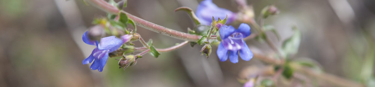
The approach to Lake Anne Pass was gorgeous, almost every step of the way. The forest was lush, full of greenery and wildflowers. There were streams every mile or so, which meant I didn’t have to carry any water. We kept up a good respectable pace until the last thousand feet or so of climbing, at which point I slowed to a crawl. This gave me a good excuse to stop and admire (and photograph) all of the interesting and exotic looking high altitude wildflowers along the trail to the pass! (I’ll save all those photos for the end.)

Tina raced up and down the trail while I crept along. She was excited because there was snow at the top, and she loves a good roll in the snow. She especially likes to slither down on her back side, kicking her feet in the air. No kidding. She’s incredible!
The wind and cold hit like a freight train on the other side of the pass. Within a minute I felt like I was getting a nosebleed and could hardly start down quickly enough. In half an hour we were finally out of the wind, in a sunny sheltered spot near some stunted spruce trees. I collapsed and drank water while the sun warmed my bones, and was felt grateful that there was no sign of hail.

We camped at Illinois Creek. I washed my socks and studied the map; 10 hours later it was time to pack up and get moving again.
In the morning the valley to the west of us was full of white foggy clouds. I stopped to admire the view and appreciate the fact that we were in sunshine, above the fog. Tina was fixated on something down in the thick willows lining the creekbed- we were being watched. Not by a bear, fortunately, but a giant moose was quietly keeping an eye on me and my furry little canine companion. The moose was almost completely hidden in the green shadows of early morning. She wasn’t alone. Ahead of her was a calf, and Momma was keeping herself squarely between Tina and the calf.

Miz Moose didn’t seem to be concerned about the fluffy silly little foxy thing prancing around my heels, so I was able to shoot a few photos before we moved off down the trail. I had seen a few tracks here and there, but wow- my first real wild Moose! Cool!
From my Journal:
September 11
Made it to Cottonwood Pass.

MP 119.
Only 12 miles hiking today.
Would have liked to go further but weather was cold and cloudy and very windy. Had sprinkles and small hail showers on way up. No cell service at Cottonwood Pass was disappointing. Camped at little lake by Pass with road close by. Felt anxious about tomorrow’s segment- all over 12000 feet with 4 big ascents.
Not a bad day’s hike though much of trail at beginning of day very torn up by bikers and dirt bikes. Wilderness portion much nicer with a nice ascent thru forest and long alpine meadows.
Sept 12
16 miles
Camping at Mp 135
Got up early. Couldn’t sleep well for worrying about weather and this segment from Cottonwood to Tincup Pass. It’s high elevation and would be miserable if precipitation. As it was the winds subsided during night but it got very cold. Tina’s water cup froze. I heard precip on tent during night and found dusting of granular snow.
Started hiking at 6. Dark. Filled water bags at lake because 6 miles to water. And 2 climbs.


Very cold. Especially when wind blew. I had to put on every article of clothing and keep moving fast just to keep from getting cold. First ascent easy, sun came up very beautiful sunrise. Hiked along ridge in sunshine felt good but then trail dropped to west side of divide in shade and wind and clouds rolling in. Heavy frost on grasses. Stayed in shade much of way to Sanford Saddle. Amazing to finally top out over the ridge into sunshine and walk down into very pleasant beautiful valley called Mineral Basin. Wildflowers, greenery and warmth of sun. Suddenly the day was looking a lot better. Kept moving along winding through basin and talus to ascent of Emma Burr ridge which was nicely graded w switch backs. Rested at top. Ahead was descent and then climb up woodchopper ridge. Didn’t look bad from afar but was steep and hard. I think the highest point of this trip (12,838′). Then 4 miles of descent endless switchbacks down to tincup Pass Road and campsite on fork of Chalk Creek. Still very cold.
Saw critter crossing talus field while climbing woodchopper ridge- like a very large weasel w bushy tail. Maybe a ….wolverine?

Friday sept 13
MP 151.4 Boss lake
This morning was effing cold again! Tina’s water cup froze almost solid. It took a big climb switchbacking up thru the forest before I could feel fingers and toes. It wasn’t until we popped out into a meadow in the morning sun that I felt like the day would be okay. My feet were cold all night long even though I rubbed them and got them warmed up I’d wake up with them cold again. Tina crawled in the bag with me which made it hard to roll over but it added some warmth. She likes to have her nose poking out.
We climbed pretty quickly to the first pass, and were surprised to find some hunters who informed me in whispers that there were deer nearby that they were going to try to shoot. I didn’t hear any guns go off tho, thankfully. I pointed out the trail and told them not to shoot in that direction.

Several other hikers went by, including Heidi from Alaska who was doing the CT south to north and whose mother lived in Denver and had just met her for a slack day in Salida and had brought her back up to the trail yesterday. She was very sweet and knew how to say hello to Tina. There are more solo women hikers than anyone would expect.
There was no cell service at the first or second passes. After the second pass we turned and started dropping down into an alpine meadow with a lake called tunnel lake. Then we dropped down to a RR grade and halfway down we met Mariah, the Hiking Nurse. We had made friends a week ago while camping at North Cottonwood Creek in the rain. Mariah was hiking clockwise around the loop, and I was going counterclockwise. She’s from Wisconsin. It was nice to sit and talk for awhile to an old friend or at least someone who felt like an old friend. I wonder if she enjoyed talking to me as much as I did her. I’ll send her a book when I get home.

The RR grade was long and straight and easy to make miles. To the left was an historic tunnel but I didn’t go that way, just stayed along the Trail. Evidently this is a popular destination for local day-hikers. After a few miles we came to a little parking lot and junction with a Jeep road. The CT followed the Jeep road for several miles and uphill. I was passed by 6 or so ATVs and Jeepy things. They make a lot of noise and go slow and stop a lot. The people inside are all bundled up with special Jeeping outfits. Goggles, face scarves etc. they smile and wave. I nod and wave but I don’t really smile except at some oldtimers who seemed really excited about being on a big adventure.

The Jeep route ended a mile from the base of the climb to Chalk Pass. I’m glad because it was really pretty high altitude alpine meadow with 2 lakes and a lot of wet meadow habitat. The climb up to Chalk Pass wasn’t bad by then, the sun felt good and wind was not bad either. Occasional chilly gusts but not that cold biting high velocity gale like some of the other passes. Which was all very fortunate because I found enough of a cell signal to get a call through to Hank who was delighted to hear from me. Even though we had the satellite texting he wasn’t happy about not getting a call or two every day, ever since Hope Pass, which seems like days ago.
So we talked until about 3:30 and I told him I was aiming to do another 5 miles so that I’d have a shot at finishing the trail tomorrow afternoon.

The trail down from the Pass was very beautiful with tarns and springs and a wet meadow all down the middle with lots of willows and wildflowers. Some hikers had also mentioned that they saw a moose in the meadow but I did not see any. I did see tracks in the mud which made me hungry for some moose tracks ice cream. We did the whole 5 miles to Boss Lake Trailhead without stopping and arrived at 5:30. But when we went down to the Arkansas River where I intended to camp, it was cold and dark and creepy. So on we went, another mile, up the steepest and roughest climb yet, and camped on the shore of Boss Lake.

The trail was so steep and rocky I started having flashbacks to the Long Trail of Vermont! I don’t know about Tina, but I’m pretty stoked to get going tomorrow and finish the hike! Actually, I think she’s a little homesick too…
The next morning we climbed to the last 12,000 foot pass of the trip. It was as hard as ever, with me creeping and crawling to the summit while Tina bounced along back and forth ahead of me wondering what was taking me so long. We sat at the top for a long time, savoring the view. I took advantage of the good cell signal to call and book a hotel for the night, and presently we stepped out again on the ridgeline of the Continental Divide, and walked back to the car waiting at Monarch Pass to take us home.


